
At a Glance
- A new storm system will sweep across the central and eastern U.S. through Thursday.
- This storm will produce more severe storms and flash flooding in the South.
- Large, damaging hail could hit the Southern Plains on Wednesday.
- Strong tornadoes are possible in the Southeast on Thursday.
A new storm system will track across the nation’s southern tier through Thursday, raising the risk of more severe storms and heavy rainfall. The storms could pack threats of large hail, damaging wind gusts, tornadoes and flash flooding, especially on Thursday.
This storm emerged from the Southwest into the southern High Plains on Tuesday. From there, it will quickly track eastward while producing widespread showers and thunderstorms in parts of the central and eastern United States through Thursday.

Locations in the South will have the greatest threat of strong to severe storms. That’s because the region has the highest chance of having sufficiently warm and moist air in order to generate intense thunderstorms.
Here’s what to expect.
Forecast
Wednesday-Wednesday Night
The chance of severe weather increases on Wednesday in the Southern Plains, including near and east of the Interstate 35 corridor from Oklahoma City to Dallas-Fort Worth, Waco and Austin, Texas. Large, damaging hail, strong wind gusts and an isolated tornado threat could accompany any severe storms that develop in eastern and central parts of Texas and Oklahoma.
Severe thunderstorms might persist into the late-afternoon and overnight hours as far east as Louisiana, Arkansas, Mississippi and western Alabama. Damaging wind gusts, large hail and some tornadoes are possible in these areas.

Thursday-Thursday Night
Damaging thunderstorms will continue in the Southeast on Thursday, perhaps with severe weather ongoing in the morning across western sections of the red areas shown below.
The threat of severe storms will spread eastward and intensify through the afternoon and evening hours, impacting parts of Alabama, Georgia, northern Florida and the Carolinas.
Tornadoes, large hail and damaging wind gusts could accompany Thursday’s severe storms. There might even be a threat of strong tornadoes in some areas. Severe weather could extend well into Thursday night toward the Southeast coast.
Since this forecast is still a couple of days away, there is still some uncertainty and changes are likely. Check back to weather.com for updates.

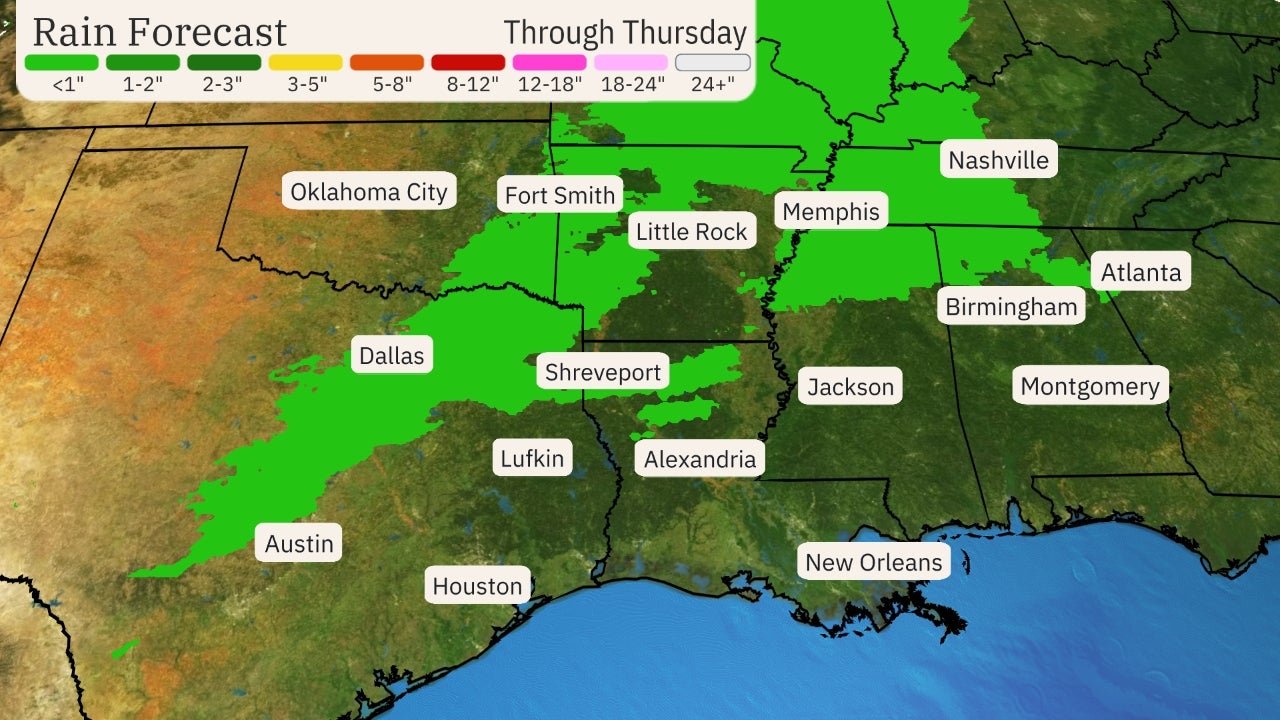
Soaking rain will also sweep through much of the South during the second half of this week.
A widespread area of the region could pick up 1 to 3 inches of rain. Localized flash flooding is possible, especially since many areas are already saturated from the recent rounds of thunderstorms during the past two weekends.
This report is sponsored by the weather channell


