
Deadly Hurricane Ian, nearing Category 5 strength, threatens ‘catastrophic’ storm surge as it nears Florida. It’s too late to leave for many, governor says
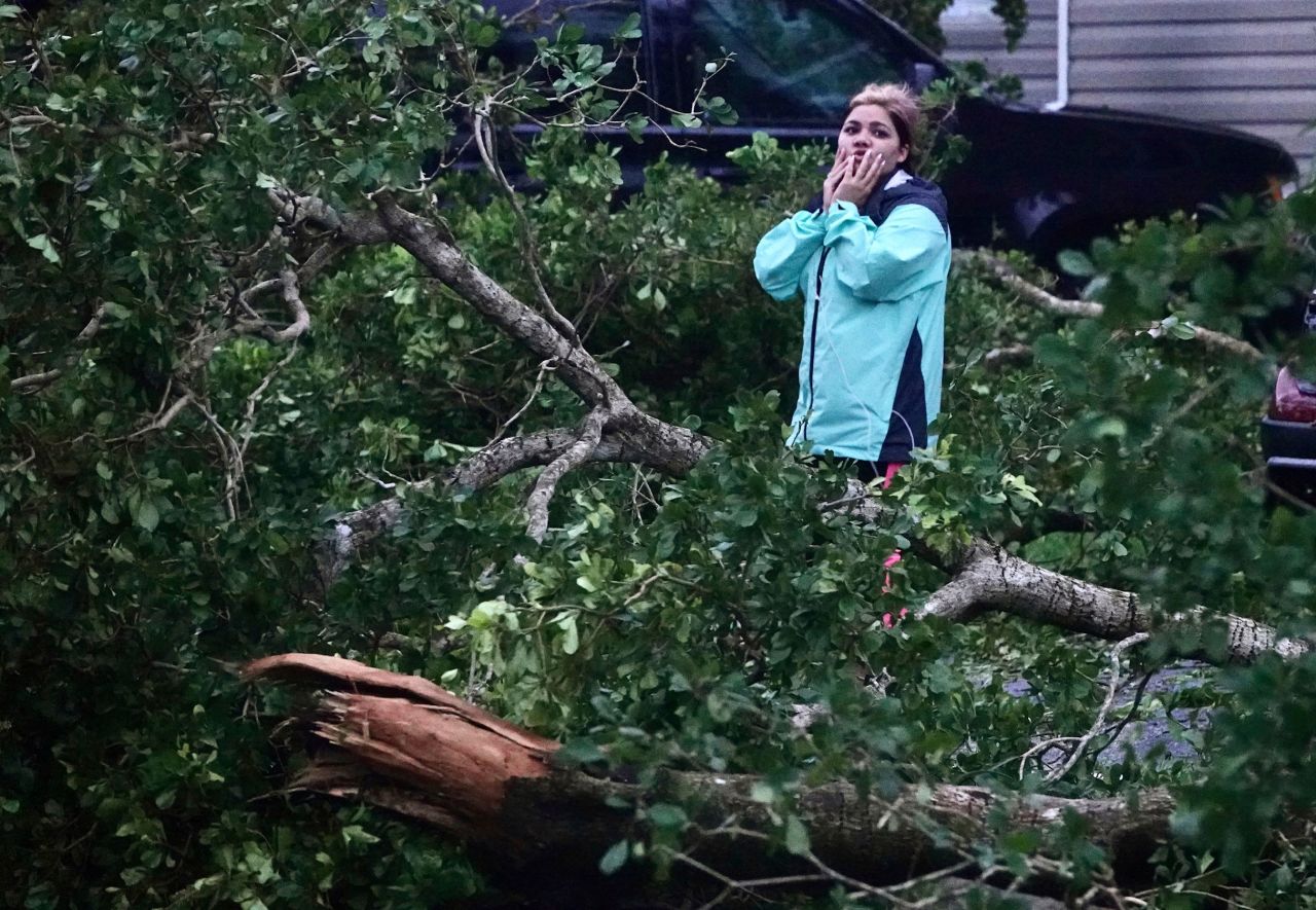
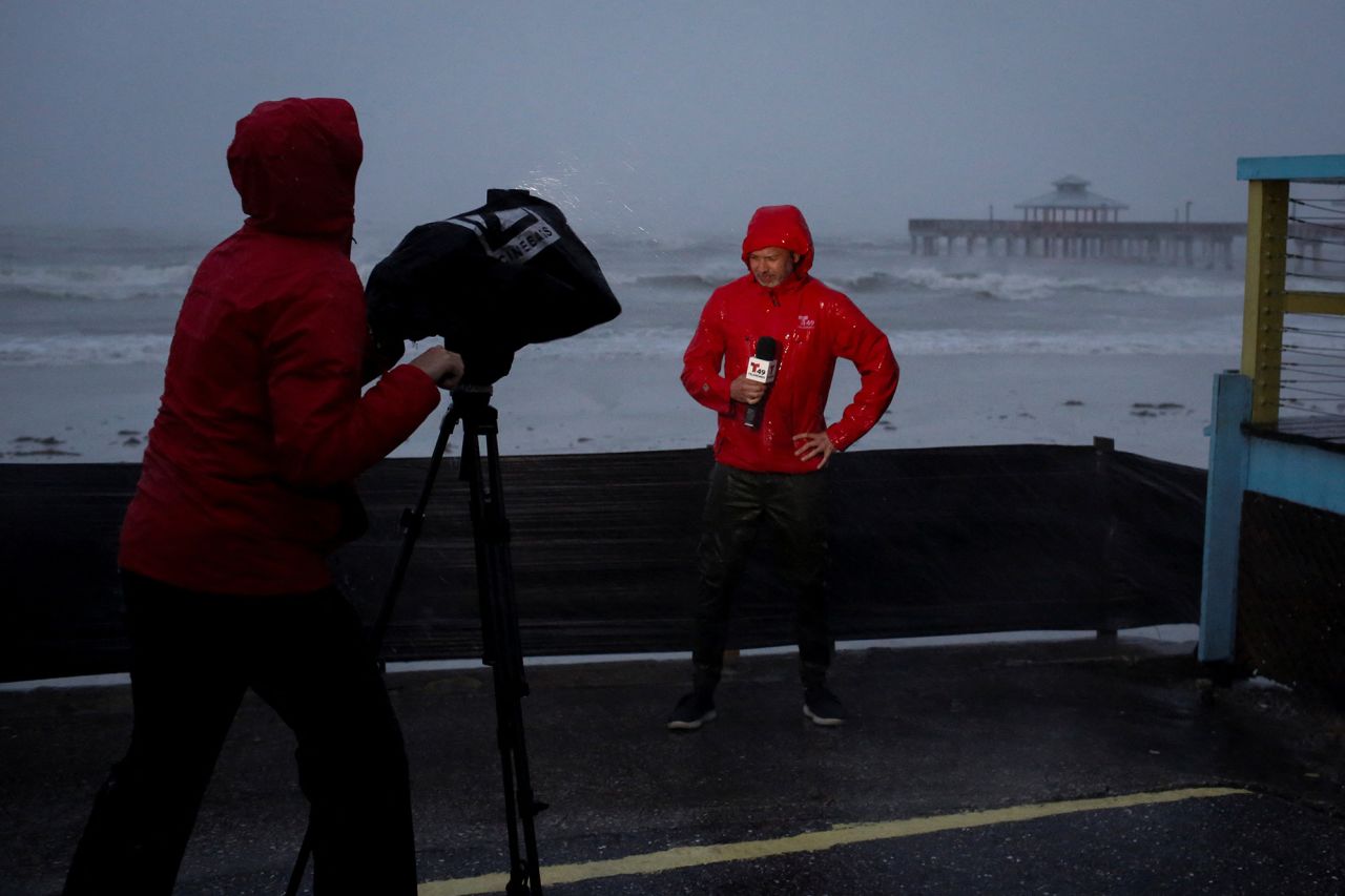
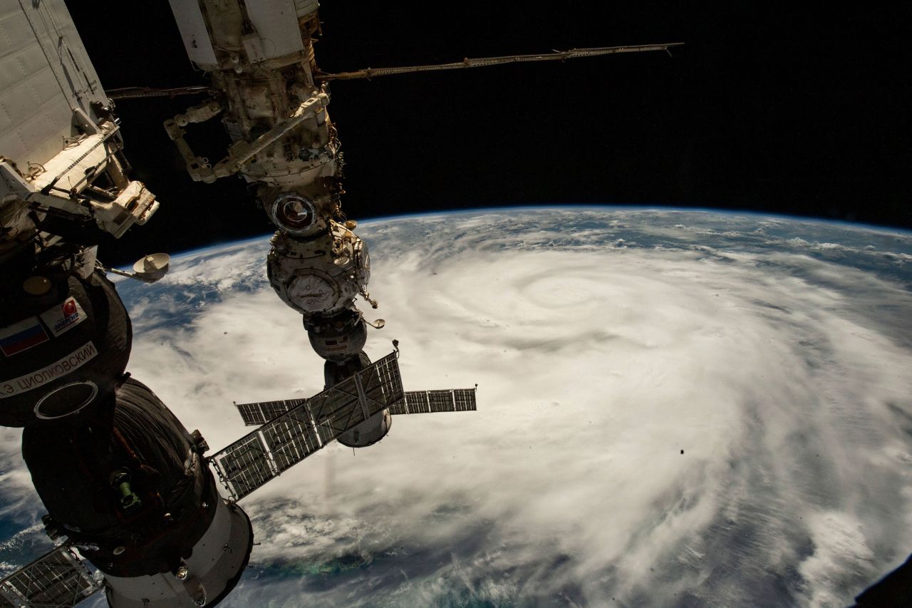
Hurricane Ian – now an “extremely dangerous” storm just shy of Category 5 strength – is poised to inflict “catastrophic” winds and storm surge as it nears a Wednesday afternoon landfall in southwestern Florida, where it already is delivering ruinous winds and rain.

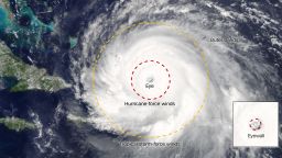
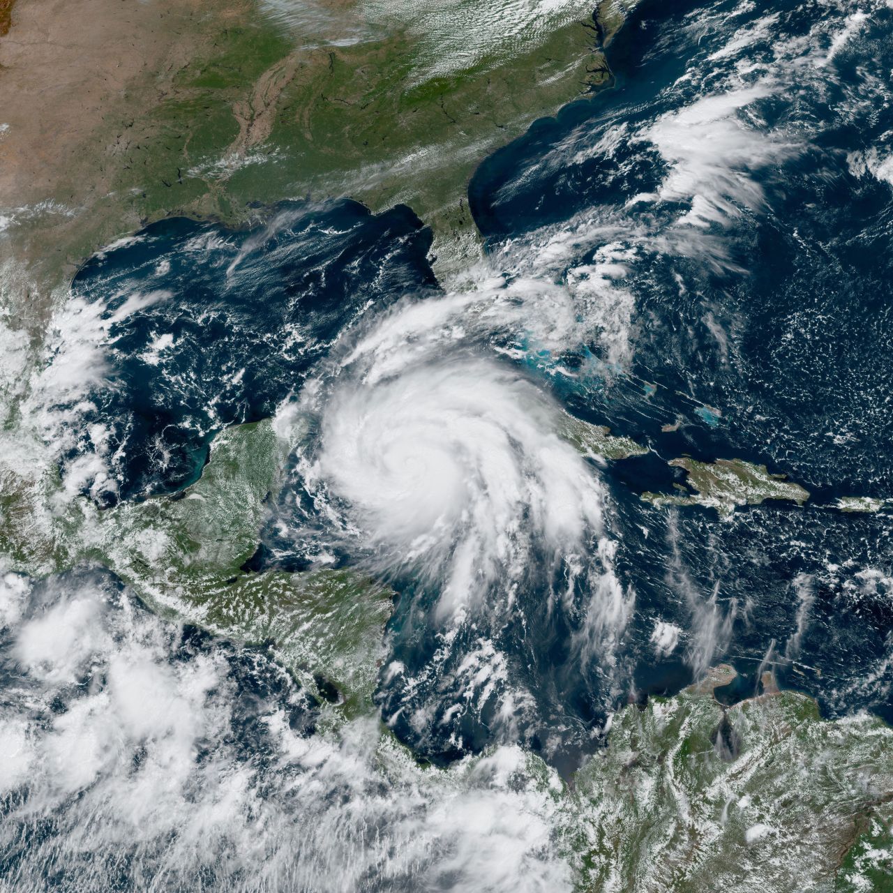
Now at Category 4 with sustained winds of 155 mph, Ian was about 60 miles west of Naples around 9 a.m. ET and its center is expected to cross onto land, perhaps north of Fort Myers near the Port Charlotte and Punta Gorda areas, by early Wednesday afternoon, the National Hurricane Center said.
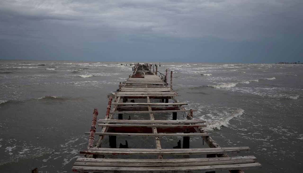
Much of west-central Florida and even places inland face disaster: “Historic” storm surge up to 18 feet is possible and could swallow coastal homes; rain could cause flooding across much of the state; and crushing winds could flatten homes and stop electricity service for days or weeks.
And for those who didn’t heed evacuation orders along flood-prone coasts, a dire warning: In some places, it’s too late to get out, and people should “move to upper floors to escape rising water if necessary,” the National Weather Service said.
IAN’S WINDS COULD BE CATASTROPHIC
Category 4: 130-156 mph
- • Most of the area is uninhabitable for weeks or months.
- • Power outages last weeks to months.
- • Fallen trees and power poles isolate residential areas.
- + Well-built framed homes sustain severe damage.
Category 5: 157+ mph
- + A high percentage of framed homes are destroyed.
- Source: National Hurricane Center
“It’s no longer possible to safely evacuate” from Collier County up to Sarasota County, Gov. Ron DeSantis said around 8 a.m., as key paths out, including the Skyway Bridge from Manatee to Pinellas counties, were closing.
“It’s time to hunker down and prepare for this storm,” he said. “This is a powerful storm that should be treated like you would treat” a tornado approaching your home.
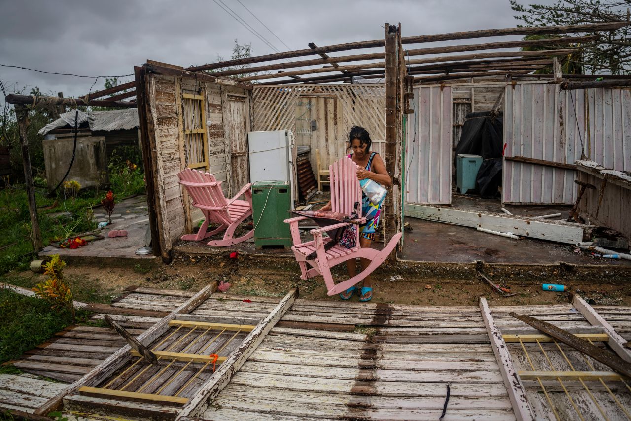
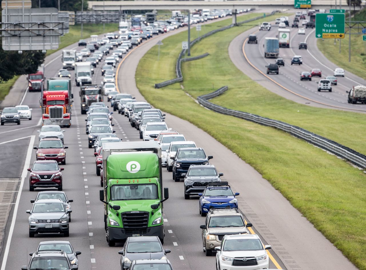
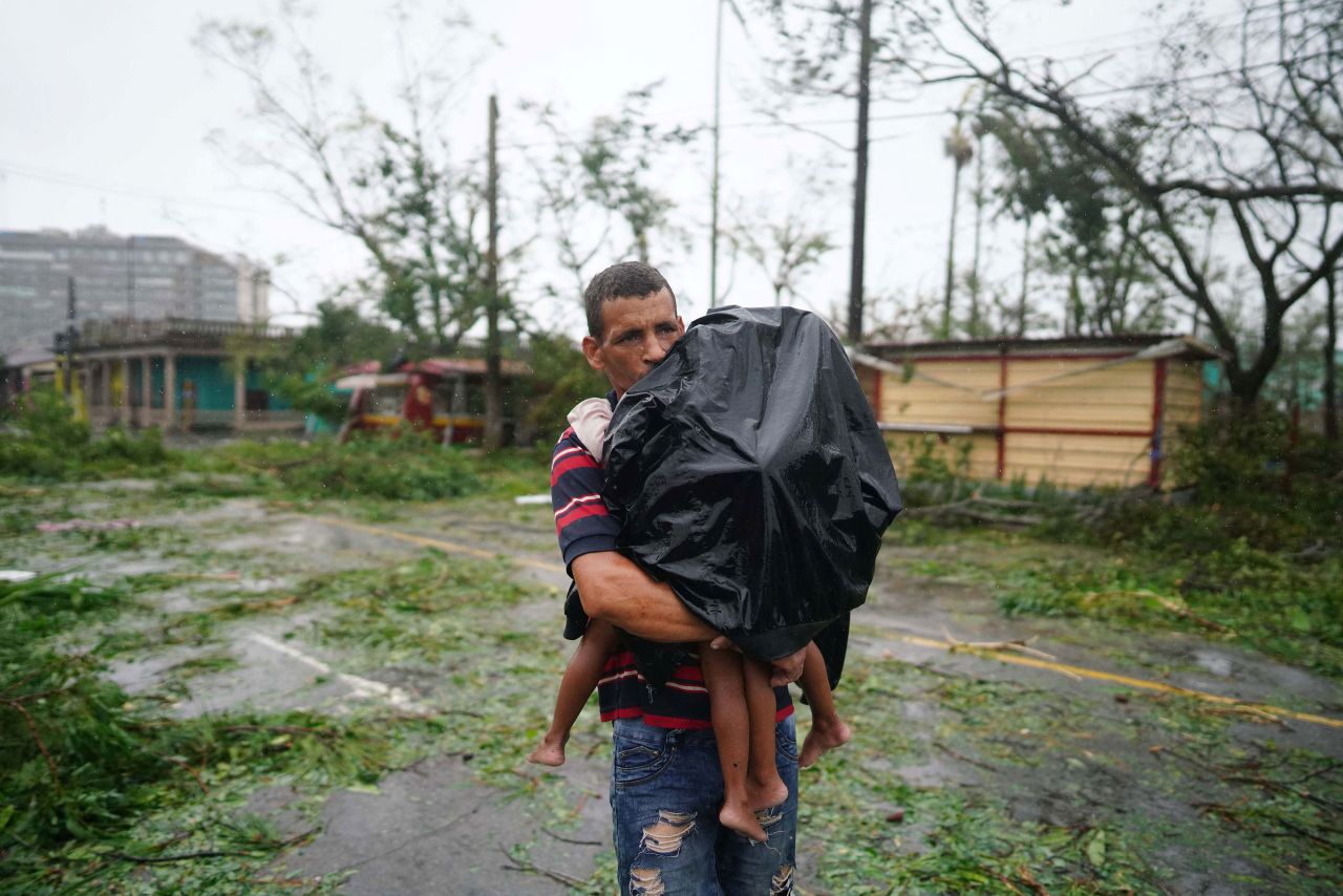
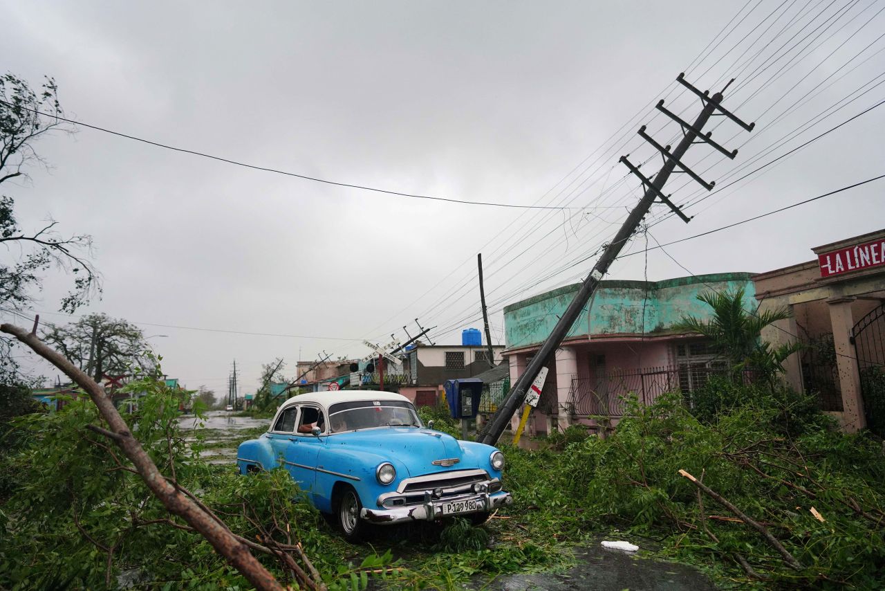
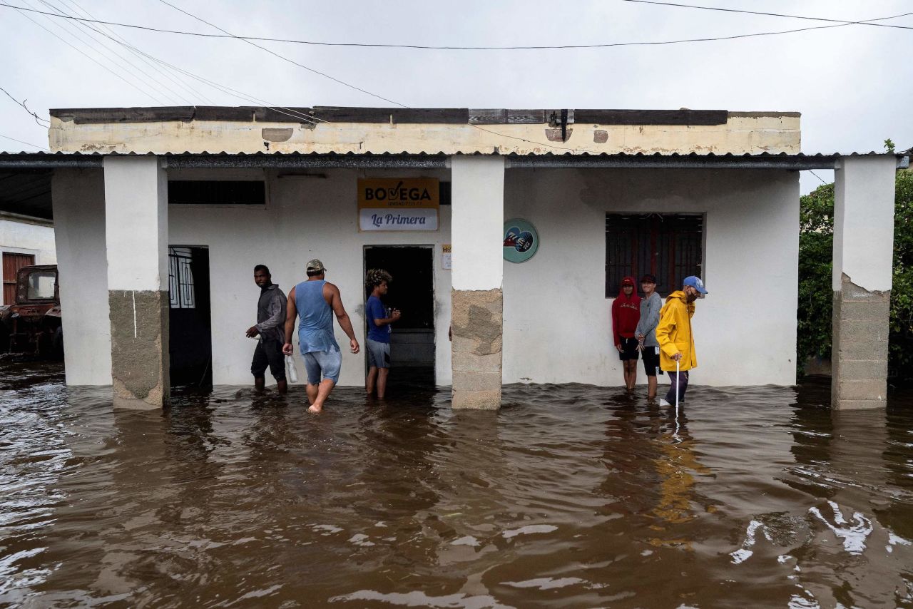
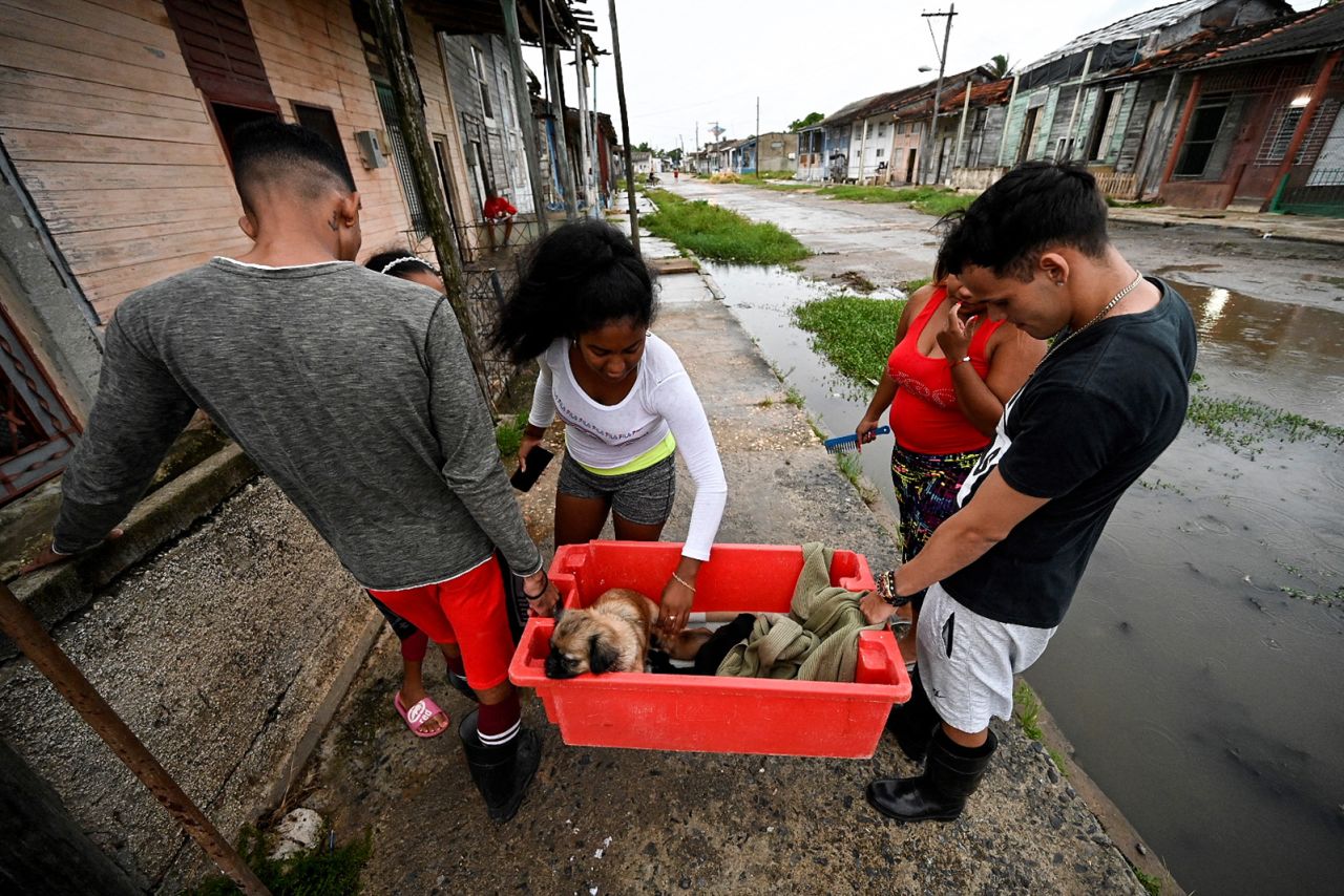
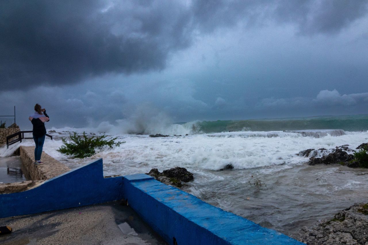
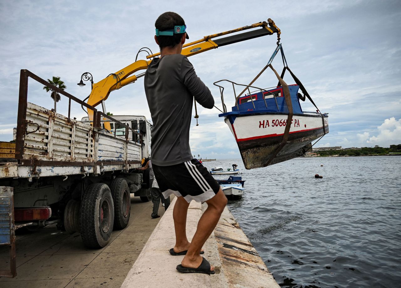
After pummeling Cuba on Tuesday, leaving at least two dead and an islandwide blackout, Ian is taking aim at Florida’s vulnerable Gulf Coast, where residents have been boarding up and leaving in droves on congested highways. More than 2.5 million people were advised to flee, including 1.75 million under mandatory evacuation orders – no small ask in a state with a large elderly population, some of whom have to be moved from long-term care centers.
Ian poses several major dangers:
• Storm surge: Some 12 to 18 feet of ocean water pushed onto land is forecast Wednesday for the coastal Fort Myers area, from Englewood to Bonita Beach. Only slightly less (6 to 12 feet) is forecast in nearby areas, forecasters said.
Lower – but still life-threatening – surge is possible elsewhere, including north of Tampa and along Florida’s northeast coast near Jacksonville.
• Winds: Southwest Florida is facing “catastrophic wind damage.” Winds near the core of Hurricane Ian could exceed 150 mph, with gusts up to 190 mph, the hurricane center said.
• Flooding rain: 12 to 24 inches of rain could fall in central and northeastern Florida – including Tampa, Orlando and Jacksonville. That makes for a top-of-scale risk for flooding rainfall across this area.
Up to 8 inches of rain is possible in South Florida as well as eastern Georgia and coastal South Carolina.

“Widespread, life-threatening catastrophic flash, urban, and river flooding is expected” across central and southern Florida, the hurricane center said.
“This is a wind storm and a surge storm and a flood storm, all in one. And this is going spread itself out across the entire state. Everybody is going to see something from this,” meteorologist Chad Myers said.
Schools, supermarkets, theme parks, hospitals and airports have announced closures. The Navy moved its ships, and the Coast Guard has shut down ports.
Parts of far southern Florida already have begun feeling the storm’s effects, with tropical storm-force winds and at least two possible tornadoes reported in Broward County, including at North Perry Airport, where planes and hangers were damaged. Major flooding was being reported in Key West due to storm surge, along with power outages.
More than 142,000 Florida utility customers already were without power as of 9 a.m., according to PowerOutage.us.
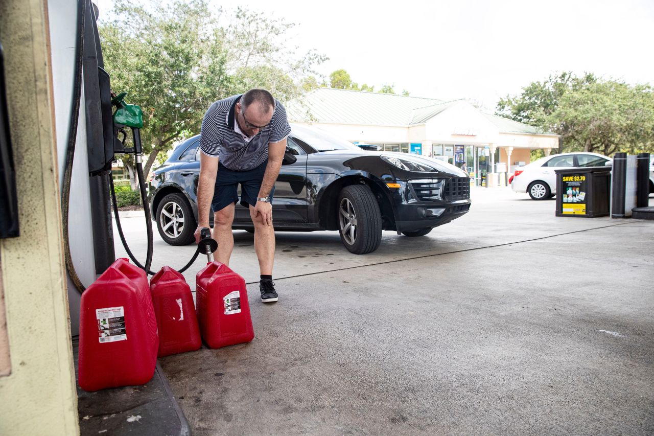
As winds pick up, gas stations may temporarily run out of fuel, DeSantis said.
A hurricane warning is in effect on Florida’s Gulf Coast from Chokoloskee near the Everglades to the Anclote River north of Tampa, including Tampa Bay, and in the Dry Tortugas. A storm surge warning is in effect for coastal areas, including Tampa Bay.

Life in Florida upended as residents prepare for landfall
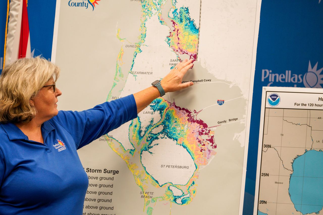
In Tampa, police went door to door Tuesday in a mandatory evacuation zone, making sure residents were ready to flee. Earlier projections had Ian on track to slam Tampa Bay – the first direct hit in 100 years. Even as the hurricane’s path shifted south, mandatory evacuations and preparations continued, Tampa Mayor Jane Castor said.
“No matter where it lands, if it does come in a little south of us, we are not getting out of this unscathed, and there is going to be flooding throughout the Tampa Bay area,” Castor said.
The governor warned of “catastrophic” flooding and life-threatening storm surge in the Gulf Coast region, with the highest risk in southwest Florida, from Naples to Sarasota.
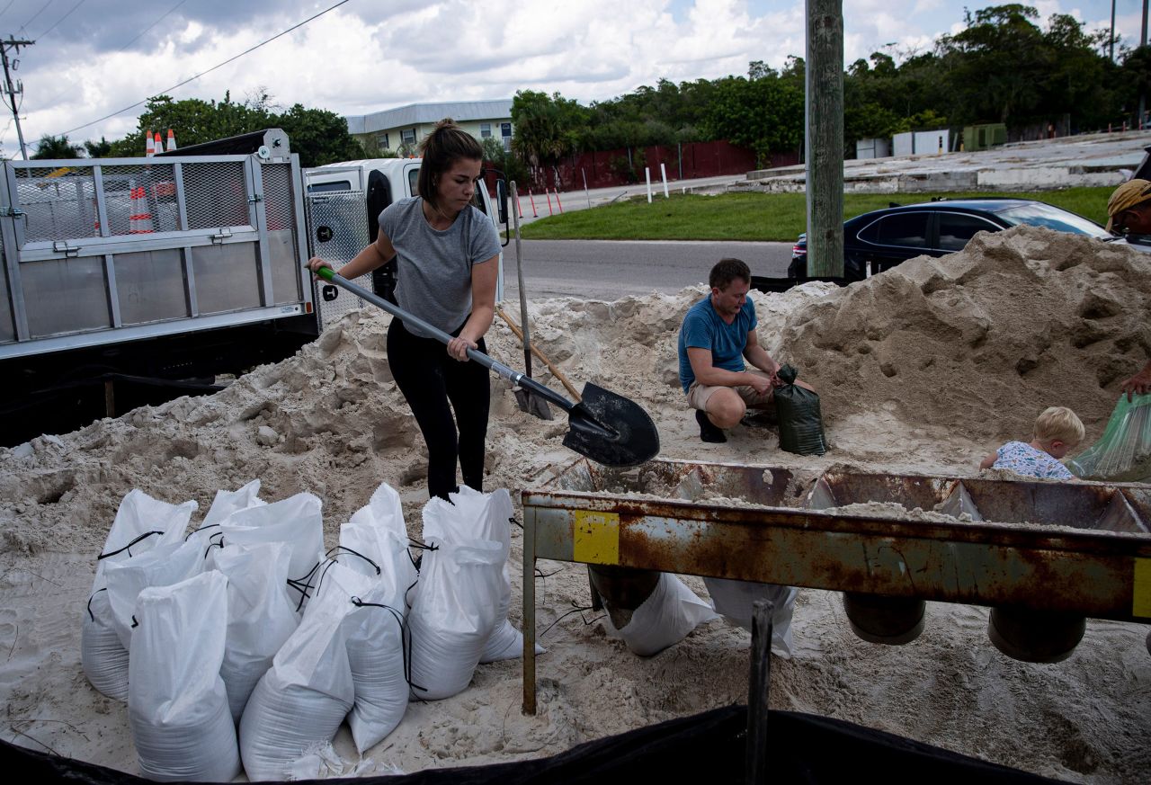
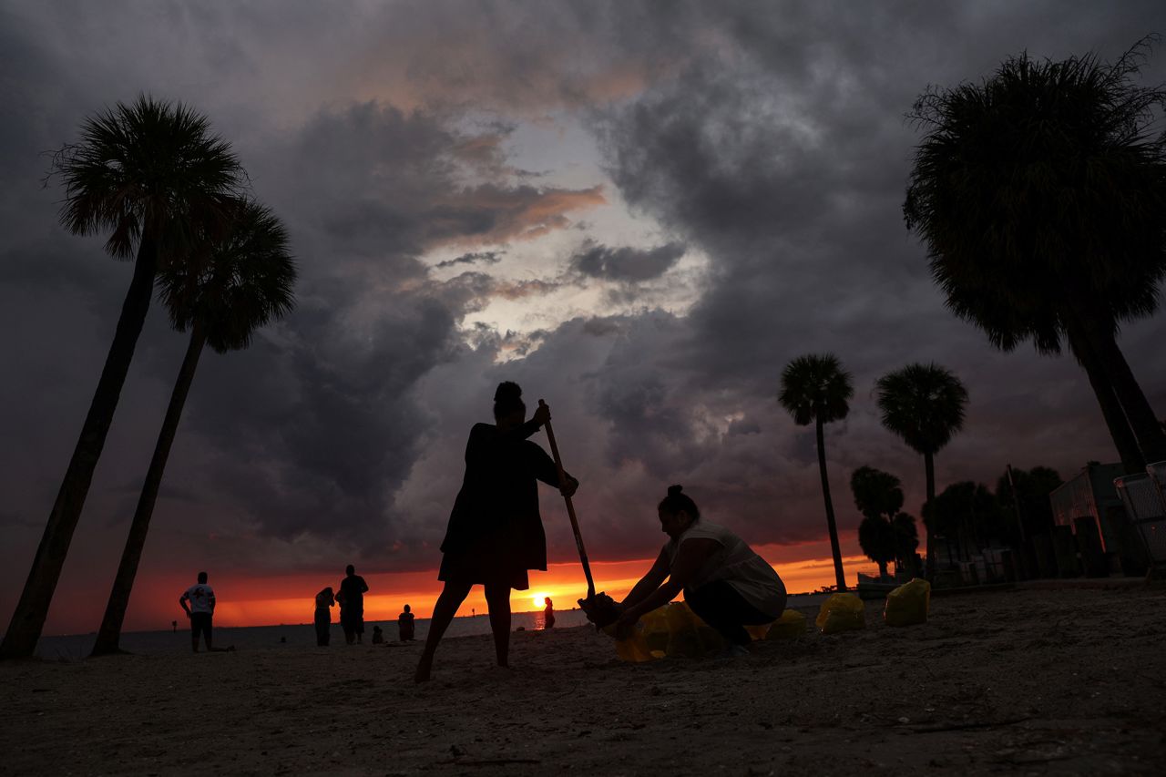
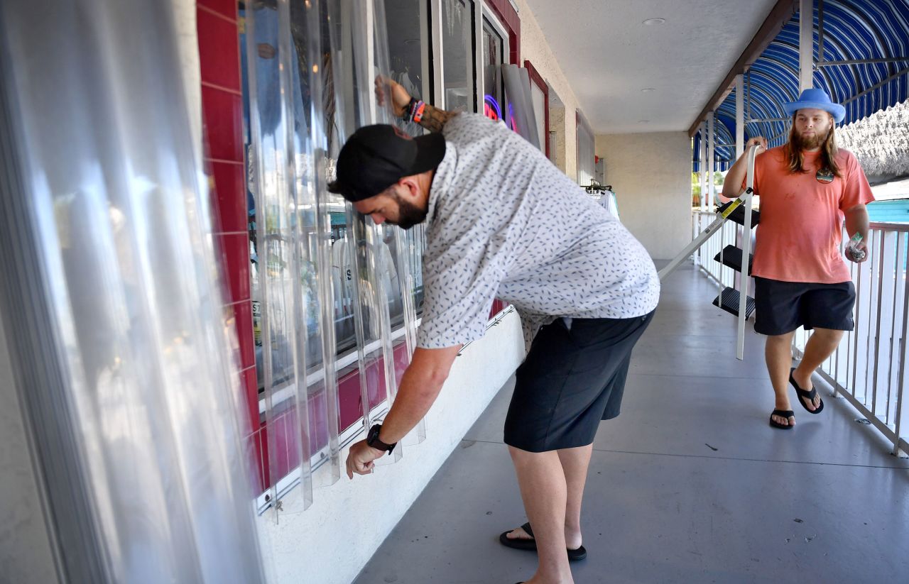
Preparations across the state have been underway for days as residents braced for Ian’s wrath. People lined up to pick up sandbags and flocked to stores to stock up on supplies like water and batteries.
And as the hurricane marched closer, the closures began.
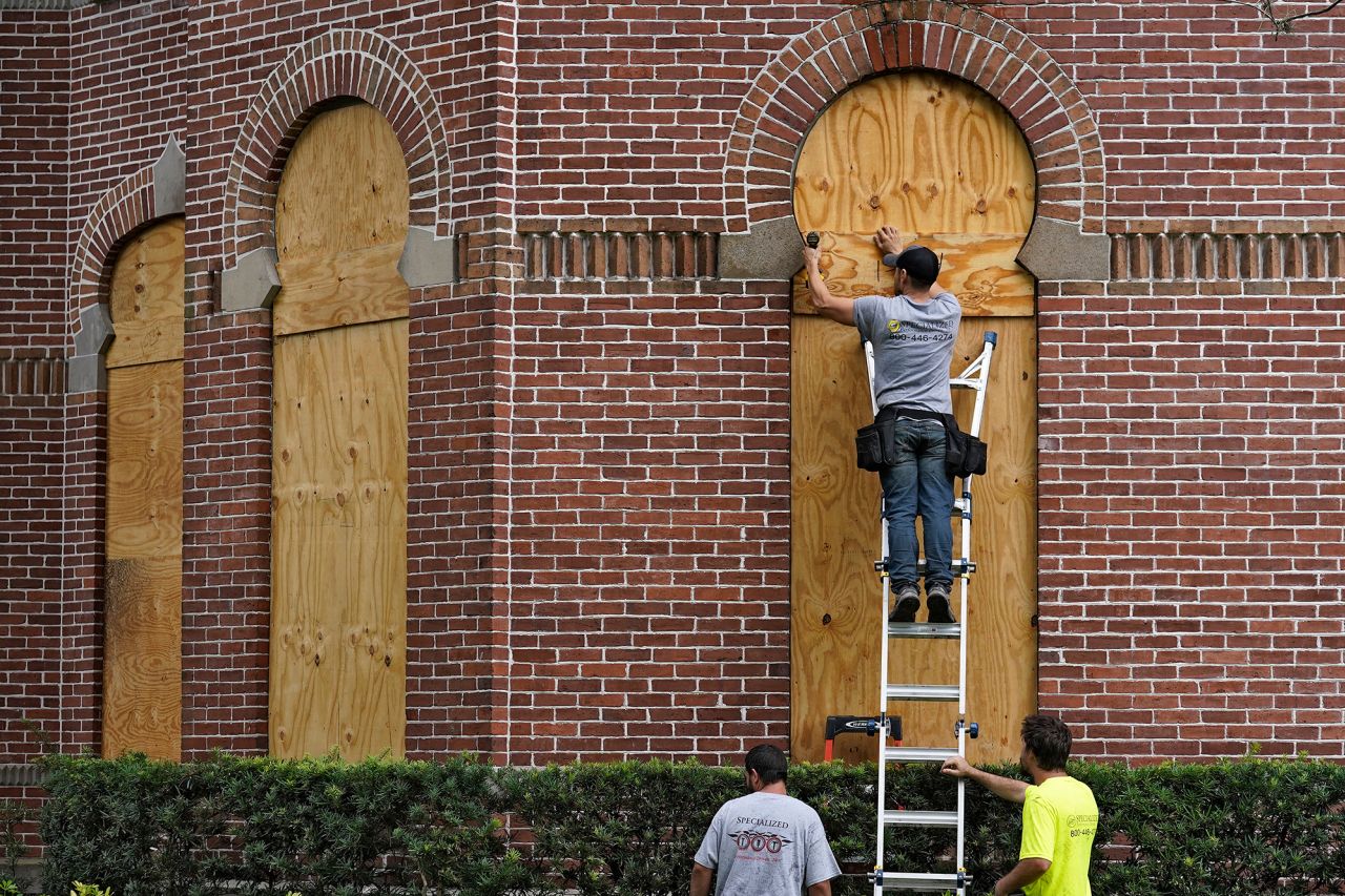


Across Florida, 58 school districts have announced closures due to storm as campuses turned into shelters for evacuees. Disney World is set to close Wednesday and Thursday, as is Kennedy Space Center’s Visitor Complex. And hundreds of Publix grocery stores shut their doors Tuesday evening, expected to remain closed through Thursday.
As millions evacuate, 176 shelters opened statewide and hotels and Airbnbs opened to people leaving evacuation zones, DeSantis said.
Local governments and state agencies also prepared those living in nursing homes and other senior care facilities to evacuate.

Florida has around 6 million residents over the age of 60, according to the state’s Department of Elder Affairs – nearly 30% of its total population. As of Tuesday, all adult day cares, senior community cafes and transportation services in evacuation zones are closed, according to the department.
Authorities also readied services to fan out and respond to calls for rescue and then, in the aftermath of the hurricane, for recovery and repair efforts.
Nearly 400 ambulances, buses and support vehicles were responding to areas where the hurricane was expected to make landfall, according to the governor’s office.
DeSantis activated 5,000 Florida National Guard members for Ian’s response operations, and 2,000 more guardsmen from Tennessee, Georgia and North Carolina were being activated to assist.
Florida urban search and rescue teams also were prepping.
“We have five state teams that are activated with additional five FEMA teams that are in play,” Florida Chief Financial Officer Jimmy Patronis said at a news conference Tuesday night. “We have over 600 resources to bear in addition to these out-of-town teams.”
After landfall, Ian will crawl over Florida
Strengthening Ian is well-defined, with a clear eye, National Hurricane Center Acting Director Jamie Rhome said in a Tuesday evening update.
“This is not what you want to see in the eastern Gulf of Mexico,” Rhome said.
When the hurricane hits, rising water is expected to move inland from the coastline, bringing life-threatening inundation and flooding to coastal areas.
Millions of people are under a storm surge warning, including the Suwannee River southward to Flamingo, Tampa Bay and the Dry Tortugas.
The area from Longboat Key to Bonita Beach, including Charlotte Harbor, could get up to 12 feet of storm surge, according to the hurricane center.
Warnings are also in place on the state’s east coast from the Flagler-Volusia county line to the mouth of the St. Mary’s River and along the St. Johns River.
After landfall, Ian is expected to crawl across the central part of the state, with damaging winds bringing the threat of tornadoes through Wednesday, according to the National Weather Service.
The slow churn over will “dump an enormous amount of rain on the state of Florida,” DeSantis said.
Ian is expected to dump at least 2-3 months’ worth of rainfall by Friday. Central and Northeast Florida is expected to get 12 to 18 inches of rain, while the Florida Keys and South Florida could get 6 to 8 inches.
Central Florida is expected to see “widespread catastrophic flash, urban, and river flooding” while the southern part of the state should brace for “considerable flash, urban, and river flooding,” the center said.
Under current projections, the hurricane is going to work its way from Southwest Florida, up to the central part of the state, then emerge over the Atlantic Ocean by late Thursday, when it could strengthen again and affect another part of the US.


