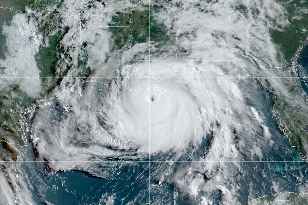
Ida was downgraded to a Category 2 Hurricane late Sunday after making landfall earlier in the day near Port Fourchon, Louisiana, as an “extremely dangerous” Category 4 storm. Its path will take it inland over portions of western Mississippi Monday and Monday night.
Following Ida’s landfall in Louisiana on Sunday, widespread flooding is forecast to follow Ida’s path inland and deluge parts of the eastern United States that have already dealt with devastating flooding earlier this month.
At 11:55 a.m. CDT, Ida made landfall as a Category 4 hurricane near Port Fourchon, Louisiana. Residents along the Louisiana Gulf coast are still cleaning up from last year’s barrage of tropical landfalls. In preparation, mandatory evacuations were issued across Louisiana coasts, leading to a traffic standstill on parts of Interstate 10.
Around 2 p.m. CDT on Saturday, Ida made a second landfall in the state southwest of Galliano, Louisiana. Maximum sustained winds at the time of the second landfall were 145 mph.
Around 9 p.m. CDT, Ida was officially downgraded to a Category 2 Hurricane with maximum sustained winds of 105 mph. On the Saffir-Simpson Hurricane Wind Scale, a Category 2 hurricane has maximum sustained winds between 96-110 mph.
The powerful tropical cyclone is likely to hold together through Monday as it moves over land, even after moving away from the warm waters in the Gulf of Mexico, as it presses northward across the lower Mississippi River Valley. At the same time, a cold front will be sweeping through the northern tier of the United States.
Because of this combination, AccuWeather meteorologists predict that the impacts from Ida will expand well inland from where the hurricane made landfall.
“Away from the immediate Gulf Coast, Ida is expected to bring impacts from western Louisiana to Georgia and the central Florida Panhandle on northward through the Tennessee Valley and into the Northeast,” said AccuWeather Senior Meteorologist Dan Pydynowski.
Impacts will be vast and include damaging wind gusts in the Mississippi River Valley along with rain up through the mid-Atlantic coast. Wind gusts of tropical storm strength, which is 39 mph or greater, may extend as far inland as southwestern Tennessee through Tuesday. However, the most widespread impact from Ida is expected to be the heavy, tropical rainfall associated with the storm.
The heaviest rain is likely to remain concentrated closer to landfall, allowing for 8-12 inches of rain across southeastern Louisiana and extreme southwestern Mississippi. An AccuWeather Local StormMax™ of 24 inches is possible in this zone.
But, several inches of rain are forecast to fall across an area much farther northward and eastward from the Louisiana coastline.
“Following the path of Ida across the eastern United States will be a swath of heavier rain, likely to produce a total of 4-8 inches of rain,” Pydynowski warned. “Some of the locations in Tennessee that were hit hard with flooding downpours earlier this month” are along this projected path, he added.
The heavy rain event in Humphreys County on Saturday, Aug. 21, dumped an estimated 17 inches of rain on the region, killing nearly two dozen and leaving catastrophic damage to property in its wake. The hardest-hit towns in the county included Waverly and McEwen, which are still cleaning up following the flooding.
President Joe Biden declared a state of emergency for not just Humphreys County, but also Dickson, Hickman and Houston counties in Tennessee following the flooding.
CLICK HERE FOR THE FREE ACCUWEATHER APP
In addition to the heavy rain in the Tennessee Valley, rain is also forecast to impact portions of the mid-Atlantic and the Northeast. However, exactly how distinguishable Ida will be as a tropical system by that time is still in question.
“The same front that will be steering Ida eastward after it makes landfall will also merge with the tropical system. While it might be hard to find the center of Ida by the middle of the week, the transported tropical moisture will likely enhance rainfall from the Ohio Valley to the East Coast,” said Pydynowski.
More than 2 inches of rainfall is forecast to expand from the Tennessee Valley into portions of the Northeast and southern New England.
Many major population centers across the Northeast have already had a wet end to the summer. As of Aug. 29, New York City had recorded more than 10 inches of rain so far during the month, a staggering 226% of its normal rainfall during August.
When compared to normal, Washington, D.C., has been even wetter with 279% of the city’s normal rainfall. Adding heavy downpours to these already wet areas could make them more easily susceptible to flooding when Ida’s rainfall arrives.
Hartford, Connecticut and Boston are also in a similar situation, with both cities receiving more than 200% of normal rainfall so far in August. A large chunk of this rain came just this past week when Hurricane Henri impacted the area.
Travelers across the Northeast should be prepared for delays Wednesday into Thursday, especially on the roads where heavy, tropical downpours could lead to reduced visibility and ponding on roadways. Residents should keep a close eye on local streams and creeks, as they are likely to be the first to flood.
Behind Ida, high pressure is forecast to move into the eastern U.S. later on Thursday, bringing drier conditions for those recovering from the hurricane’s impacts.
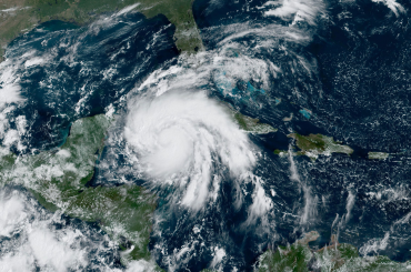
Ida began as a tropical rainstorm in the western Caribbean on Thursday, Aug. 26, and quickly ramped up to a tropical storm with 40-mph sustained winds later that evening. Ida reached hurricane status Friday afternoon before making its first of two landfalls in Cuba. Since emerging over the Gulf of Mexico, Ida not only maintained hurricane status, but became increasingly intense throughout the weekend.

Author
David Brooks


